Island of Montreal Maps
Island of Montreal maps that, as a whole, usually show physical features such as rivers, mountains, forest and lakes in various colors. Mountains shown in brown, rivers and lakes shown in blue, places of low elevation shown in dark green and, as the elevation increases, the color becomes light green and then it becomes orange.
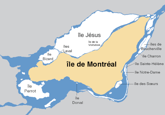
Montreal Online Maps
That said, there are many types of Montreal maps, boroughs free maps, cities free maps, street maps, online maps, road maps, driving maps, topographic maps, satellite maps... Maps are important mostly because of the precise information they supply.
All kinds of maps offered by each borough and each city of the Island of Montreal. Maps of the Island of Montreal, maps of the City of Montreal, maps of each of the 19 boroughs, maps of of each of the 15 reconstituted cities, maps that help us figure out where we are, where we wish to go and how.
Boroughs Physical Maps
A series of Boroughs Physical Maps to help you find a particular training center, a local park, an outdoor pool, a community garden, a municipal building, a metro station ...
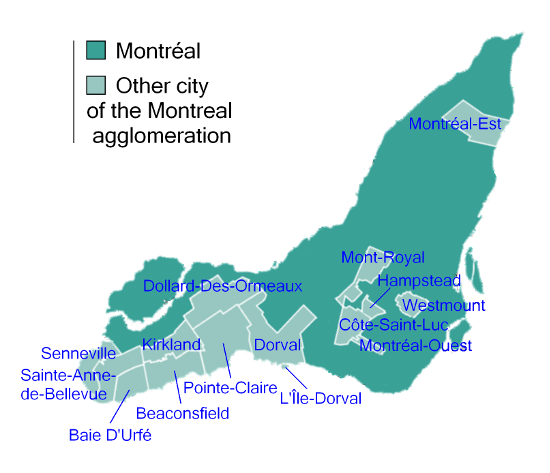 Cities of the Island of Montreal
The purpose of each of our borough maps is to help you determine what you wish to find or to explore. All kinds of maps to find whatever is important to you or what interests you somewhere, anywhere on the Island of Montreal.
Nowadays, each borough council has its own budget and each borough offers direct services to its residents. Services that include cultural activities, maintenance of public places, local parks, municipal roads, sports activities that you can easily locate with each borough and each city map.
Cities Physical Maps
Cities Physical Maps about the Island of Montreal with its City of Montreal divided into 19 boroughs that each have their own Montreal physical map, along with its 15 reconstituted cities that also have physical maps for each of their city, town, ville and village.
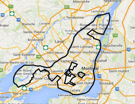 City of Montreal
 Each city offers local services to all its respective residents just like the city of Montreal does and each City Council in each reconstituted city offers very similar local services to its residents.
Urban Agglomeration Montreal Maps
In 2002 the Parti Québécois merged all the cities of the Island of Montreal into one mega City. In 2006 the Parti Libéral partially de-merged the Island of Montreal into 16 cities, 15 independent cities including the very small Dorval Island along with the City of Montreal divided into 19 boroughs.
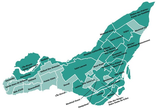 Cities and Boroughs of the Island of Montreal
The entire Island of Montreal officially called the Agglomeration of Montreal is governed by an Agglomeration Council. A Council that offers shared services in each borough and each city map.
The costs of these services are shared by the tax payers in both boroughs and cities. Taxpayers in boroughs and in reconstituted cities receive a separate tax bill for their part of shared Agglomeration services.
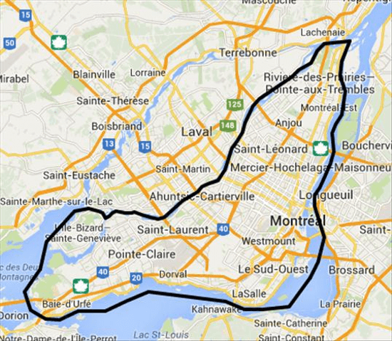 Island of Montreal
The Agglomeration Council also offers Montreal en Statistiques that provides various information such as demographic and economic profiles for each borough and each city of the Island of Montreal.
The main topics covered are employment, business establishments, household spending, residential manpower and residential construction and housing. Facts and figures that are available by subject, by territory and by all kinds of Montreal physical maps.
Montreal Kits
Island of Montreal Maps
Disclaimer Keep in Touch! Montreal Tourism
Privacy Policy Rachel Louise Barry Sitemap
Montreal Kits © All Rights Reserved 2018-2024
The information provided by Montreal Kits is informational only and has no legal value.


